Trail Happenings March 2011
What’s In A Trail Name?
by Geoff and Sandy Freethey
Trail names are interesting and may be descriptive, historic, or just plain fun. The Grand County Trail Mix Committee develops and maintains a variety of trails in its position of advising the County Council on non-motorized trail issues. One of its more interesting and sometimes controversial tasks is naming proposed bicycle and hiking trails.
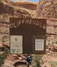
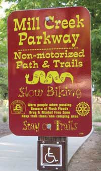
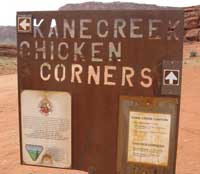
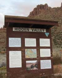
In the past the BLM and Forest Service generally used names that are descriptive and geographic such as Slickrock, Tower Arch, Mill Creek, Hidden Valley, Spring Canyon, North Fork, Flat Pass, the Portal and Moab Rim, along with countless Cottonwood Canyons. Four wheelers often use trail names that warn against disasters and frequently mention jeep parts such as: Metal Masher, Widow Maker, Wipe-Out Hill, Steel Bender, Axle Hill, Rocker Knocker, Chicken Corners, and Cliff Hanger.
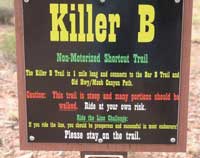
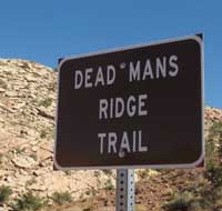
Mountain bikers lean toward more colorful names that relate to a trail’s adrenaline producing ability, or toward names that create easily remembered acronyms. For instance, Hazzard County, Rockstacker, Killer-B, Minesweeper and Deadman’s Ridge might imply one could expect some difficulties on the trail.
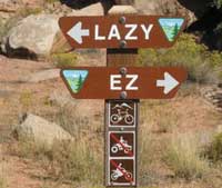
The new Lazy-EZ trail has an asterisk defining the trail as not very lazy and only relatively easy. The same applies to Baby Steps which is definitely not for newly minted mountain bikers.
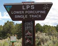
Acronyms are popular because they roll off the tongue rapidly and they enlist a degree of mystery to those visitors unfamiliar with the area. M&M, UPS, LPS, WE, UFO and EKG trails make visitors wonder how these somewhat familiar initials became trail names. M&M is not named because it “melts in the mouth-not in the hand”, but simply stands for Monitor and Merrimac buttes. UPS does not assist in delivering parcels, but stands for Upper Porcupine Singletrack; which helps decode LPS as Lower Porcupine Singletrack. The Whole Enchilada Trail is known in some circles as the WE. The UFO trail passes near a rock formation that reminds one of a flying saucer from “War of the Worlds” and the EKG trail not only gets your heart racing but even mimics the zigs and zags of an EKG printout from your doctor.
The first four trails in Moab Brands mountain biking focus area used cattle brands (Bar-M, Circle-O, Rockin’-A, and Bar-B) as trail names to spell “MOAB”. Subsequent names have retained a western flavor -- Deadman’s Ridge, North 40, Lazy EZ, Long Branch (saloon), and Rusty Spur.
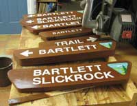
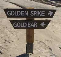
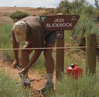
Movies have inspired a few recent trail names. Mag-7 aka The Magnificent 7 Trail System includes seven trails stretching from Highway 313 to the Potash Road (SR-279). Mag-7 features magnificent views of Bull Canyon, Gemini Bridges, Gold Bar Rim, and Poison Spider Mesa. “Star Wars” inspired trail names, Jedi Slickrock and the proposed Wookiee’s Way, are in the Tusher Mountain Bike focus area, just east of the Bartlett Slickrock.
Historic names are found everywhere on trails. Richardson Amphitheater is named for Dr. Sylvester Richardson also known as the “professor” of Professor Valley fame who was a teacher and postmaster.
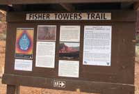
Amasa trail is named for Amasa Larson, a cattleman in the 1880s. The Jewel Tibbetts Arch and trail are named for the wife of Bill Tibbetts. Their story was recently published in the, Last of the Robbers Roost Outlaws book by McCourt. Negro Bill Canyon is named for William Granstaff, a prospector and cowboy. The Fisher Towers are named after brothers, Gull and Avill Fisher, who were early settlers and cattlemen.
The Sovereign trail system was mostly developed on state Sovereign managed lands. The trails were built by Ride with Respect who (along with its program director, Cliff Koontz) recently won national recognition for Outstanding Trail Sharing at the American Trails National Symposium. Names to interesting points along the Sovereign trail are a tribute to the folks who made these trails a reality through years of planning and hard work -- Parriot’s Potholes, Cozzen’s Construction, Schwarck Switchback, Terry’s Tunnel, Richard’s Ridge, Howe’s Hairpin, and Ann’s Arroyo.
The Klondike Bluffs takes its name from the 1896 Klondike Gold Rush in the Yukon Territory. The name reflects the golden glow on the bluffs during late afternoons, hence “Klondike”. Proposed trail additions to this focus area may be named Skagway and Grubstake which will continue the Klondike historical thread. Mega Steps, is seemingly related to dinosaur track ways found in the vicinity.
About the authors: Geoff Freethey, a retired hydrologist, is the hiking representative to the Trail Mix Committee. He is responsible for many of the trail signs, and “you are here” maps on the trails. Sandy Freethey is the Chair of Trail Mix, and actively organizes everyone. Both enjoy hiking, rafting, traveling and searching for rock art.
 Trail Mix This committee represents non motorized trail users including: bikers, hikers, equestrians, and skiers. Many government agencies and private citizens comprise the “mix” that makes this group work so well. We meet the 2nd Tues. of each month from 12-2 at the Grand Center (500W. 182 N.). Everyone is welcome. Trail Mix This committee represents non motorized trail users including: bikers, hikers, equestrians, and skiers. Many government agencies and private citizens comprise the “mix” that makes this group work so well. We meet the 2nd Tues. of each month from 12-2 at the Grand Center (500W. 182 N.). Everyone is welcome.
Contact Sandy Freethey 259-0253 or find us online: wwwgrandcountyutah.net/trailmix/ or at moabtrailmixinfo@gmail.com.
|
|