Read last month part 1 of the Geologic Maps article HERE
Geologic maps are the single most important source of geologic information. They show the distribution of rock layers (formations to geologists), the location of faults and folds, along with other geologic information. Accompanying sheets contain the legend with detailed description of each rock layer as well as geologic cross sections that project rock units below the surface to show their three-dimensional orientation.
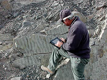 |
| Geologist Doug Sprinkel mapping with a hardened field tablet. Doug has been mapping in the Uinta area for nearly 30 years. |
Overall, geologic maps contain so much information that if I had to select the single best geology book of any given area, I would choose a geologic map instead. Most geologists share this perspective as maps provide the most concise and comprehensive overview of a region's geology. Geologic maps are the heart of the geosciences.
Geologic maps revolutionized the study of the earth, and provided innumerable benefits to society, providing critical information about mineral and energy resources, natural hazards, and transportation routes. The first detailed geologic map on a nation-wide scale was the 1817 map of England by William "Strata" Smith that was so impactful that it earned the moniker "the map that changed the world."
Likewise, in the United States, geologic mapping had a significant impact on the young country, particularly in the West where large areas that were still considered to be "the great unknown." The first accurate geologic map of a part of Utah was John Wesley Powell's map of the eastern Uinta Mountains, published in 1876.
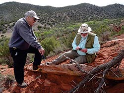 |
| Geologists Hellmut Doelling and Doug Sprinkel at an outcrop in central Utah. Hellmut has served the UGS for nearly 70 years since his college days at the University of Utah. At age 90, he continues to drive into the San Rafael Swell to map almost every week. |
Until fairly recently, much of the technology used in mapping has been unchanged since Powell's day: shoe leather, rock hammer, compass, hand lens, and rock color chart. The mapper does fieldwork to collect geologic information by visiting outcrops, walking ridgelines, and following contacts (the boundaries between rock layers). This geologic information is overlain on a base map, typically a topographic map, aerial photograph or satellite imagery. In addition to drawing contacts and recording the surface traces of faults, geologists record information about the orientation of rock layers (i.e., how they are tilted or folded), measure their thicknesses, and take notes about the presence of fossils and features such as ripple marks that provide information about the environments in which they were deposited.
In recent years, handheld GPS units, electronic field tablets and data collectors, and georeferencing (GPS) cameras have revolutionized mapping, yielding more precise and accurate data, and bringing important efficiencies in the cartographic processes necessary for the publication of geologic maps.
Grant Willis, the Geologic Mapping Program Manager at the Utah Geological Survey and who has been with the mapping program since its inception in 1983, said, "Technology has changed things so fast, that after nearly 150 years of mapping the geology of the state, I honestly feel like we need to start over. Technology has given us several things—the ability to fit in more detail, much better spatial accuracy, and much better age control. Today, we build all geologic maps over high-resolution aerial imagery."
 The Utah Geologic Survey, a division of the Utah Department of Natural Resources, is responsible for overseeing Utah's mapping programs. Since 1992, most geologic mapping in the United States has been accomplished through the National Cooperative Geologic Mapping Program, which is a partnership between state governments, the US Geological Survey, and universities. The federal government provides most of the funding, and state geological surveys work collaboratively with universities and the USGS on mapping projects. The Utah Geologic Survey, a division of the Utah Department of Natural Resources, is responsible for overseeing Utah's mapping programs. Since 1992, most geologic mapping in the United States has been accomplished through the National Cooperative Geologic Mapping Program, which is a partnership between state governments, the US Geological Survey, and universities. The federal government provides most of the funding, and state geological surveys work collaboratively with universities and the USGS on mapping projects.
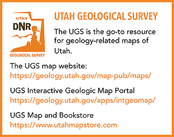
The UGS has geologic maps available for purchase www.utahmapstore.com and many maps are available for free download from their website. The UGS website also contains the interactive Geologic Map Portal where users can view and query hundreds of geologic maps, and can zoom in or out, view descriptions of map units, and even tilt maps to view in 3D.
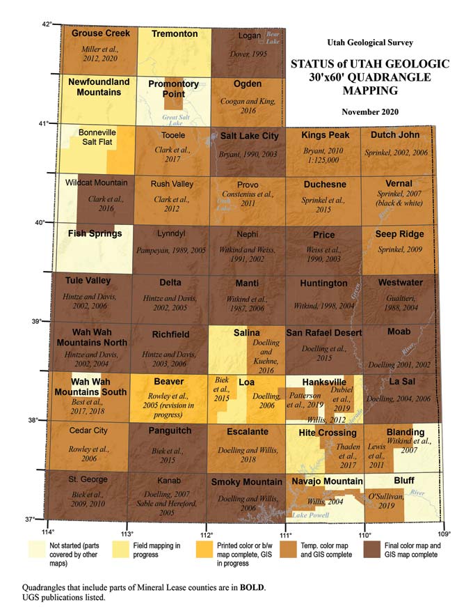
The UGS has published geologic maps of Arches National Park, and of the Moab and Gold Bar Canyon 7.5" quadrangles, with more maps in development. The effort to geologically map Utah continues. Grant explained, "People often assume that Utah has already been mapped. In a way, it has—we have complete coverage of the state at 1:250,000-scale, two-thirds at around 1:100,00-scale, and nearly half at 1:24,000-scale. But, most of these maps don't even come close to meeting our modern needs for spatial accuracy and precision. On a scale of 1 to 5, most only score a 2 or 3."
Utah is a geologic mapper's paradise. As Grant tells it, "A couple of decades ago, I was leading a field trip in central Utah with participants from around the country. After riding around with me for a couple of days, with me spouting off geology as fast as I could and still not getting it all in, a geologist from Kansas turned to me and said, 'You Utahns have more geology in a square mile than we have in our entire state!' In a way it's true, Utah is absolutely loaded with geology. I feel like the luckiest guy in the world to have gotten to spend my life mapping that geology."
Special thanks to Grant Willis, Utah Geological Survey.
All images are courtesy of the Utah Geological Survey.
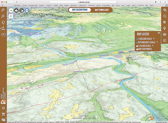 |
| Screen capture from the Geologic Map Portal showing a tilted view of Moab and the Portal. |
|