PALEO HAPPENINGS September 2020 |
|||||||||||
| A Dinosaur Freeway alongside the Seaway by Martin Lockley, Moab Giants | |||||||||||
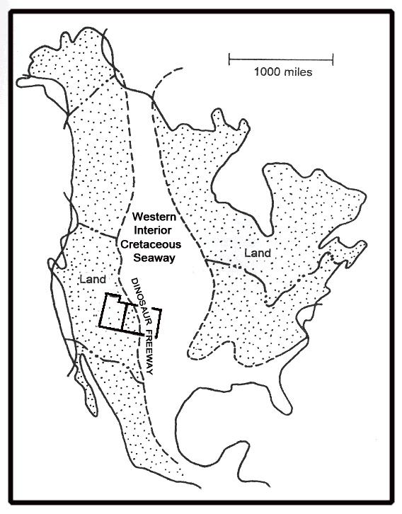
In the February issue of our 12-part tracking series we celebrated the Moab Megatracksite, representing a beach environment patrolled by large theropod dinosaurs towards the end of the Middle Jurassic Epoch (~155 million years ago). Yes, a beach, caused by a shallow sea flooding in from the north west. Fast forward 55-60 million years, long after the Jurassic sea has receded and countless generations of older dinosaurs, pterosaurs and other extinct species had come and gone, and around Moab there was another influx of the sea, what geologists call “transgressions,” when sea level rises. Or one might say the land subsided more than 4000 feet, relative to Moab’s altitude today. This time, the sea encroached both from the north and the south creating what became known as “Western Interior Cretaceous Seaway” that split the North American continent in two. At various times about 100 million years ago (give or take a couple of million) Denver, Grand Junction, Moab and Salt Lake City would have been beach front property, had they then existed. You could have walked miles inland across a humid, swampy coastal plain and still been near sea level. The swamps accumulated peat which later became coal, and being wet underfoot, it was an ideal place for animals to register tracks. Trackers might say “don’t drain the swamp” wetlands = good and diverse tracking!
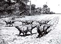
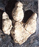
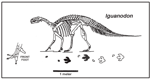
So, what does the track record of this Cretaceous coastal plain reveal? The answer is a tracker’s treasure trove. In a track-rich rock unit known as the Dakota Sandstone at least 130 dinosaur tracksites are known from as far east as Kansas to as far west as Cedar City, Utah. In the span of few million years as the seaway flooded the interior it created coastal plains so extensively trampled by dinosaurs that they have become known as the Cretaceous Dinosaur Freeway. Counting each trackway sequence (not individual tracks) as representing an individual, we census over 1000 Iguanodon-like duckbilled dinosaurs, more than 100 theropod carnivores (2 types), close to 100 armored dinosaurs (ankylosaurs), hundreds of crocodiles, and various pterosaurs and turtles. We also have new evidence of what are called “sexual display arenas” where theropod dinosaurs practiced courtship in the breeding season. This special category of track evidence, not to mention the intriguing combination of dinosaurs and sex, deserves its own treatment: so stay tuned for the next report (October). What we can say, is that these dinosaurs, pterosaurs, turtles and crocs were not just passing through, they inhabited the swampy vegetation-rich coastal region, leaving the same track types over wide areas. It could be that these coastal plains were migration routes. Dinosaur could, in theory, have walked from what is now the Gulf of Mexico, as far as Alaska. At New Mexico site 50 Iguanodon trackways are oriented to the north west, suggesting a herd on the move. By the way, although plant fossils are common, there are almost no bones, or even clam or snail shells known from this entire freeway region, probably because the coal swamp acid dissolved bones and shell. So tracks and plant fossils are the treasures that tell 99% of the story of the Dinosaur Freeway alongside the lush coast of the Cretaceous seaway.
|
|||||||||||