|
|
HIKING HAPPENINGS April 2011
Deadman’s Ridge - Big Sky Country
article and photos by Marcy Hafner
Are you ready to try out some “brand” new trails that have a nostalgic cowboy flavor? Do you yearn to head off yonder, where there’s still ample room to roam? If your answer is “yes”, then, pardner, you should round up your gear and head north of town to the big sky country of the “Moab Brand Trails” - a recently completed series of trails that have been built by the Moab Trail Mix Committee. The mission of this volunteer group, which is sponsored by Grand County, is to preserve and develop individual trails and pathways for safe, convenient and enjoyable recreational use within the county. Through their efforts, an extensive system of new trails has been constructed, which opens up new opportunities for mountain biking, hiking and cross-country skiing in the nearby La Sal Mountains.
The Bar M, Circle O, Rocking A and Bar B are the cattle brands that have been used to name the first four trails, and the single letters have been cleverly arranged to spell MOAB. Adding a little more spice to this cowboy lingo, the Lazy-EZ Trails are also available for your consideration. Mounted on your faithful mountain bike or rambling along for an out-of-the-saddle hiking experience, you’ll find plenty of wide-open space to explore. If you throw in the sidekick trails of the Killer B, Long Branch, North 40 and Deadman’s Ridge, you have a variety of challenging routes, that should keep a cowpoke busy and happy for at least a couple of hours!
To get to the Moab Brands trailhead, drive north out of town on Highway 191 for nine miles and turn right at the signs for the Bar-M Chuckwagon and Bar M Trails. Then, swing a sharp right to go directly south on a graveled dirt road. In about one half a miles, the paved Colorado River-Gemini Bridges bike/pedestrian pathway comes in under the highway through a culvert and continues its course alongside the dirt road, which you are driving on. As bike path and road run their parallel course, only a wire fence separates them, and at this merger, the road has narrowed down to one lane, with strategically placed pull-outs to avoid oncoming traffic.
After two miles, the roadways split - the 8.5 mile bike/pedestrian pathway continues on through Moab Valley, and the dirt road turns east. Soon after that, a four-wheel drive, high clearance vehicle is needed to negotiate a small section of large rocky protrusions. Parking, however, is available before that at the bulletin board, with overflow parking immediately to the left.
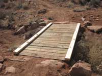
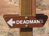
Not too far past the 4X4 section on the road, which is now part of the Bar B Trail, the Lazy-EZ Trails start on the left and move along in a northerly direction. Immediately after that, on the right, the Deadman’s Ridge Trail also begins. The 1.2 mile connection of this trail to the other end of the Bar M is open, but the remaining portion, which drops steeply over to the paved bike path, is still under construction.
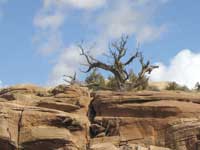
The name Deadman’s Ridge intrigues me, and after crossing the wooden bridge, I start my circuitous walk. Miles and miles of visibility reach out to the Bookcliff Mountain Range on the northern horizon, while the alpine wonderland of the La Sal Mountains dominates the southeastern skyline. Closer in, I absorb the extensive views of the Bar-M Chuckwagon, Archview Campground and Seven Mile Canyon, as well as Moab Canyon, which is bordered on the western side by the sheer cliff walls of Navajo Sandstone. In this vast uplifted land, I am transported to another dimension – a euphoric feeling of being disconnected from all the entrapments of civilization and traffic that exist below.
Beyond a crest in the trail, those telltale sights of the modern world disappear - now the big screen picture is completely dominated by a wilderness setting, as the impressive profiles of Skyline Arch and The Windows in Arches National Park come into view. This scene deserves a much longer look, and a slanted rock conveniently provides me with a comfortable backrest. Cherishing this undisturbed time of contemplation, when the trails are still so empty, I look down on a land of rocks, rocks and more rocks – up-ended rocks, protruding rocks, piles of rocks that dot the vast terrain of the rich brown-colored earth.
A pair of horned larks, voicing their distress with calls that sound like tinkling glass, flee from my intrusion. I always catch glimpses of these elusive birds in the driest of the dry land. For whatever reason, their preferred habitat is the most barren real estate they can possibly find. Even their genus name, Eremophilla, is Latin for “desert-loving,” which describes their fondness for bare, open ground. In their meager existence, they somehow manage to scrounge up weed seeds, waste grains, caterpillars, ants, wasps, grasshoppers and spiders.
Sometimes these tenacious birds flock together by the thousands, but at this time of year they are splitting off to set up housekeeping. It seems early in the mating season to establish a breeding territory, but then horned larks are one of our earliest nesting birds, raising as many as three broods a year.
For years, I wondered if these sparrow-sized birds really had those tufts of feathers that looked like horns, or was it a figment of someone’s imagination? Since I was never able to sneak in for a close enough look, I couldn’t be sure until a courting male came in to strut his stuff. I didn’t move a muscle, and unaware of my presence, he hung around. Now, I could clearly observe the yellowish face and throat, the black eye stripe, the black bib, and best of all, I finally verified: These birds really do have horns!
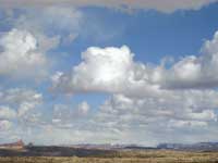
Winter has been marching on and the last of the snow and mud is gone. A quagmire no longer exists, and the going is now so easy. The sunshine plays peek-a-boo with dark thunderheads, which have been gathering all day in a rain-threatening mood - big puffballs of fleecy looking black-and-white sheep that accentuate the intense blue sky. I watch in fascination as they grow and embrace - connect and disconnect, as fat bellied clouds give birth to more clouds. Suddenly, however, rain seems imminent and that triggers my response to start moving on!
Dropping down to the east, there is a major intersection with the Bar B, Bar M and Rocking A Trails. If you’re pressed for time, the quickest, most direct way back to the trailhead is the Bar B Trail. From this location, the corridor of Courthouse Wash can be seen, and if you do have the time, it is worth the short walk over the gray slickrock to peer down on the sheer walls that enclose the width of this canyon.
By late afternoon, the shadows have started creeping across the desert land. As the last solar rays illuminate the oddly shaped rock structures and highlight the snow-covered La Sals, the sun gradually meets the earth with a brilliant explosion of colors – a memorable performance marking the end of a great day in this big sky country.
|
Biological Soil Crust (aka)
Cryptos (krip’ tose):
The surface of
Moab’s desert is held
together by a thin skin of living organisms known as cryptobiotic
soil or cryptos. It has a lumpy black appearance, is very
fragile, and takes decades to heal when it has been damaged.
This soil is a critical part of the survival of the desert.
The cryptobiotic organisms help to stabilize the soil, hold
moisture, and provide protection for germination of the seeds
of other plants. Without it the dry areas of the west would
be much different. Although some disturbance is normal and
helps the soil to capture moisture, excessive disturbance
by hooves, bicycle tires and hiking boots has been shown
to destroy the cryptobiotic organisms and their contribution
to the soil. When you walk around Moab avoid crushing the
cryptos. Stay on trails, walk in washes, hop from stone to
stone. Whatever it takes, don’t crunch the cryptos
unless you absolutely have to! |

Cryptobiotic soil garden
|
|
|
|
|
|
|
© 2002-2026 Moab Happenings. All rights
reserved.
Reproduction of information contained in this site is
expressly prohibited.
|
|