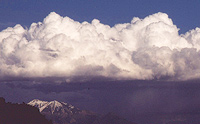
 Talking about August monsoons on the Colorado Plateau’s high desert seems like an oxymoron. This is a land of little rain as highlighted by Moab’s average precipitation of 9-10 inches annually, yet during the late-summer monsoon season spectacular thunderstorms may drench the region with long-anticipated rain; it’s a beauty and beast type of situation.
Though the rains bring a welcomed relief to this arid landscape, the storm clouds may have a dark lining with lightning and flash floods accompanying these storms. Heeding the daily forecast of, “Chance of afternoon thunderstorms,” should play into everyone’s summer schedule.
 The life cycle of a thunderstorm follows sun-driven pattern in late summer. The mornings often start out with clear skies and warm temperatures. As the mercury rises throughout the day, the warm air rises and carries any moisture upwards, eventually creating cumulus clouds. As the air begins to cool at higher elevations, and the moisture condenses, the forming cumulus cloud releases heat, which furthers the ascension or updraft of this now moist air.
Often, these clouds may do nothing more than create a beautiful backdrop or contrast to the redrock scenery. As the cumulus clouds lazily float by, often the promise of rain evaporates as the clouds dissipate.
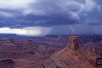
But sometimes these clouds continue to grow as the warm moist air rises vertically. sometimes forming a classic anvil-shaped cumulonimbus cloud, better known as a thunderhead. As precipitation continues to condense within the cloud, the cloud’s underbelly appears darker. Downdrafts within the thunderhead drags the heavier, moisture-laden air downward resulting in precipitation and the release of static electricity in the form of an electrical charge or lightning. This is the moment when beauty may turn into a beast. 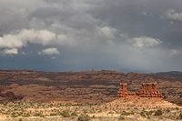
The incredible speed of the lightning heats up the surrounding air and results in a shock wave or the thunder that we hear. Counting the seconds between lightning flash and the thunder and dividing by five, gives a rough estimate as to the distance between you and the storm. The speed and heat intensity are astounding during a cloud-to-ground strike which is why standing at exposed viewpoints or unprotected overlooks is not the best idea during a thunderstorm. Being able to hear the thunder or being within six miles of the storm is a good reason to seek safety (less than 30 seconds between lightning and thunder clap).
Sometimes associated with these thunder and lightning events is precipitation which may or may not hit the ground. Virga are the strands of rain that for a curtain beneath the base of a storm cloud which evaporate before hitting the ground.
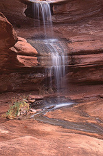 Other times, the thunderstorm cells may unleash a fast and furious rainstorm. These hard rains may last a short time or continue in duration until they slow and finally dissipate. The intensity of the event will also determine the chance a flash flood will form. These floods can have devastating impacts on roads, hiking trails, water courses, and any areas that act as drainage. It’s always a good idea to check the weather in late summer prior to traveling in narrow canyons or areas prone to flooding. Flash floods often happen with little to no warning, and they may begin farther away than your current location.
These flooding events can be fascinating and spectacular, but deadly at the same time. Be aware when trying to hike or drive through any flood waters especially when you don’t know the depth of the flood. Watch out for debris and seek higher ground to be safe from floods as you may have to wait out the surging waters. Be aware of rockfall, as water is a powerful agent of erosion and may move loose rock and soil. Seeing old debris piled up around cottonwood trees or deposited high out of a canyon bottom is a good indicator of the beauty and beast of Nature.

 A natural history writer.